DTCP Approved • RERA Registered
Connectivity Map

Everything Sterling Enclave Is Close To

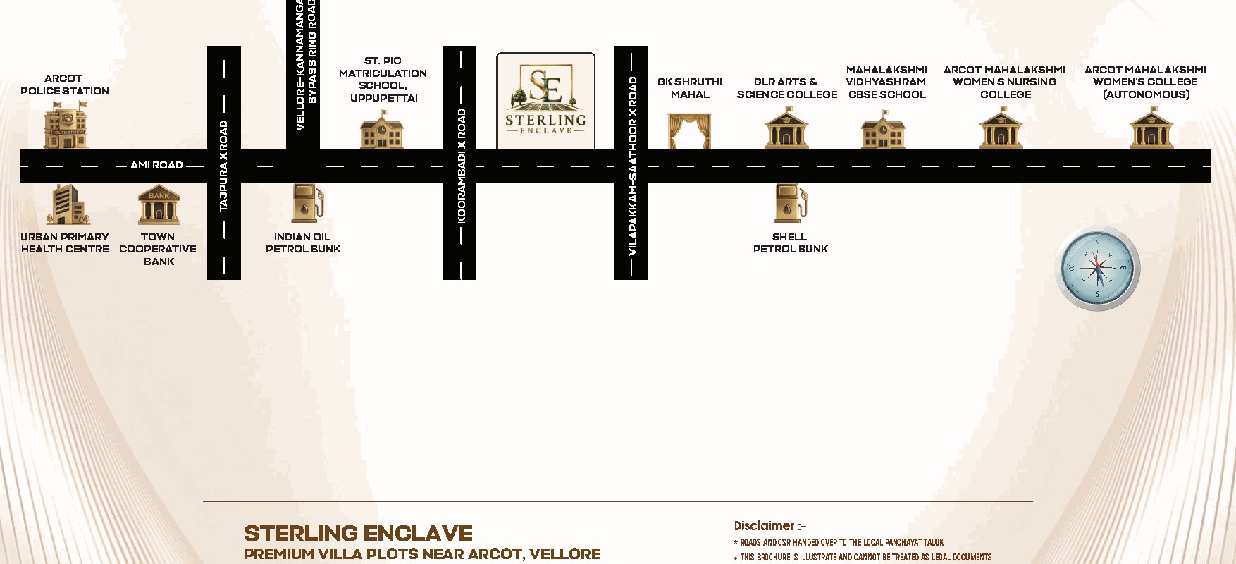
Sterling Enclave regional connectivity map near Arcot
Distances

Minutes Away From Everyday Essentials

Transit & Roads

  • Arcot Bus Stand4 Mins
  • Vilapakkam Bus Stand5 Mins
  • Timiri New Bus Stand5 Mins
  • Ranipet New Bus Stand8 Mins
  • Vellore Cantonment Railway Station30 Mins
  • Vellore Town Railway Station30 Mins

Education

  • Saint Pio Matriculation School2 Mins
  • Mahalakshmi Vidhyashram CBSE School2 Mins
  • Sri Kalaivani Vidyalaya Nursery & Primary School3 Mins
  • Govt Higher Secondary School3 Mins
  • Brills Vidyashram5 Mins
  • DLR Arts and Science College (Co-Ed)3 Mins
  • Arcot Sri Mahalakshmi Women's College (Arts & Science)3 Mins
  • Arcot Sri Mahalakshmi Women's College — School of Nursing3 Mins
  • Pasumpon SSS College of Arts, Science & Management6 Mins
  • G.V.C. College of Education6 Mins

Healthcare

  • Dr. Ponnambalam Hospital5 Mins
  • Fathima Hospital6 Mins
  • GD Hospital6 Mins
  • Arcot Government Hospital6 Mins
  • Sri Sakthi Amma Hospital20 Mins

Heritage & Leisure

  • Vellore Fort28 Mins
  • Tipu & Haider Mahal29 Mins
Why This Location

Arcot & Vellore — A Region On The Move

Arcot is a well-established town on the Chennai–Bengaluru corridor, with Vellore's healthcare, education and administrative hub close by.

Vellore district is home to nationally known institutions and hospitals, and Arcot itself sits on AMI Road, close to the Arcot New Bypass (the Vellore–Kannamangalam bypass ring road) — giving Sterling Enclave residents quick access to schools, colleges, hospitals and both Vellore railway stations.

For families and investors alike, a DTCP approved, RERA registered layout so close to an established town centre is a rare combination — the infrastructure of today with room to grow into tomorrow.

See It For Yourself

Book A Free Site Visit

Let us show you the layout, the blocks and the connectivity in person.